Bases
Google Earth images of SWASPES and the surrounding area where Operation Yahoo took place in the first half of 1982.
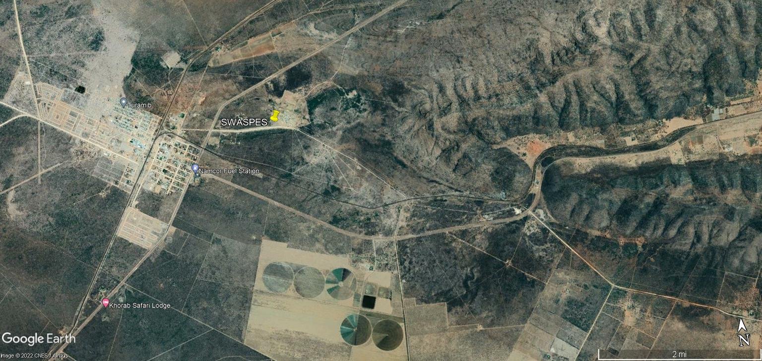
Otavi area, including the western end of the valley. In 1982 there were no crop circles or development west of the railway line in town (the black line), or south of town. The entire area including the valley was densely bushed.

Otavi and the old SWAPES base in 2022. Road at bottom right corner goes to Grootfontein, top right corner to Tsumeb, bottom centre to Otjiwarongo.
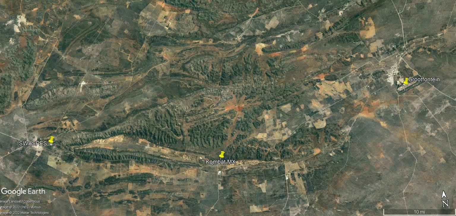
Otavi/Grootfontein area in 2022. The narrow valley east of Otavi is clearly visible. Kombat copper mine ceased operations due to corruption and flooding in 2008 and was reopened under new management in late 2021. Just north of the mine was 'Kombat MX', a nice sand track that served Platoons 11 and 12 well.
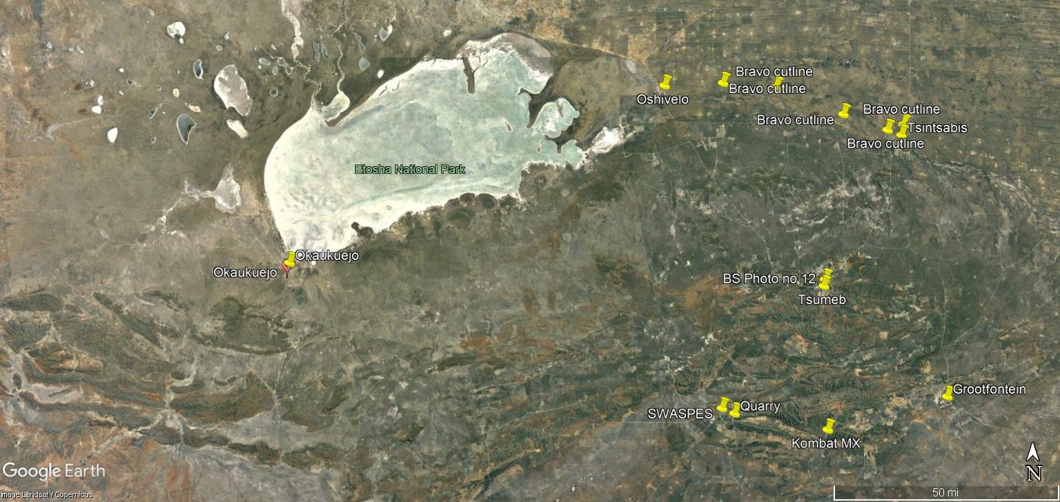
The Tsumeb/Otavi/Grootfontein 'triangle' seen from space. The agricultural engine of northern Namibia (SWA as it was in 1982) was the target area for SWAPO's 'Volcano' terrs every autumn, after the rains stopped and allowed travel through the bush. Platoon 11's participation in Ops Yahoo covered this entire area to 80 or so km south of Otavi and Grootfontein.

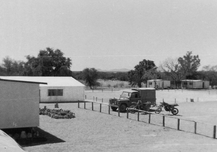
View of SWASPES looking north-east from the bike park. Bike and horse office at left, the mess hall beyond that. Open area in the distance was used for training, chopper pad, parade ground, PT area etc. The stables and dog kennels were at the northern end, behind the trees at left, and 'Back of the Stables' track in the bush beyond that. This part of the base was terraced, the gate is behind and to the right of the photographer's position. (2/Lt. JJN Hagen photo)

Otavi main street looking east. The Otavi Hotel was (is?) one of the buildings at left.

Google Earth image of Tsintsabis. Note the two 90-degree corners in the Bravo cutline just north-west of the base. In the early 1980s the diagonal white road leading north did not exist, and Tsintsabis itself was little more than a name on a map.

Wider view of the Tsintsabis area. The Bravo cutline continues west to Oshivelo, out of frame to the left. Tsintsabis to Oshivelo is 90 km.
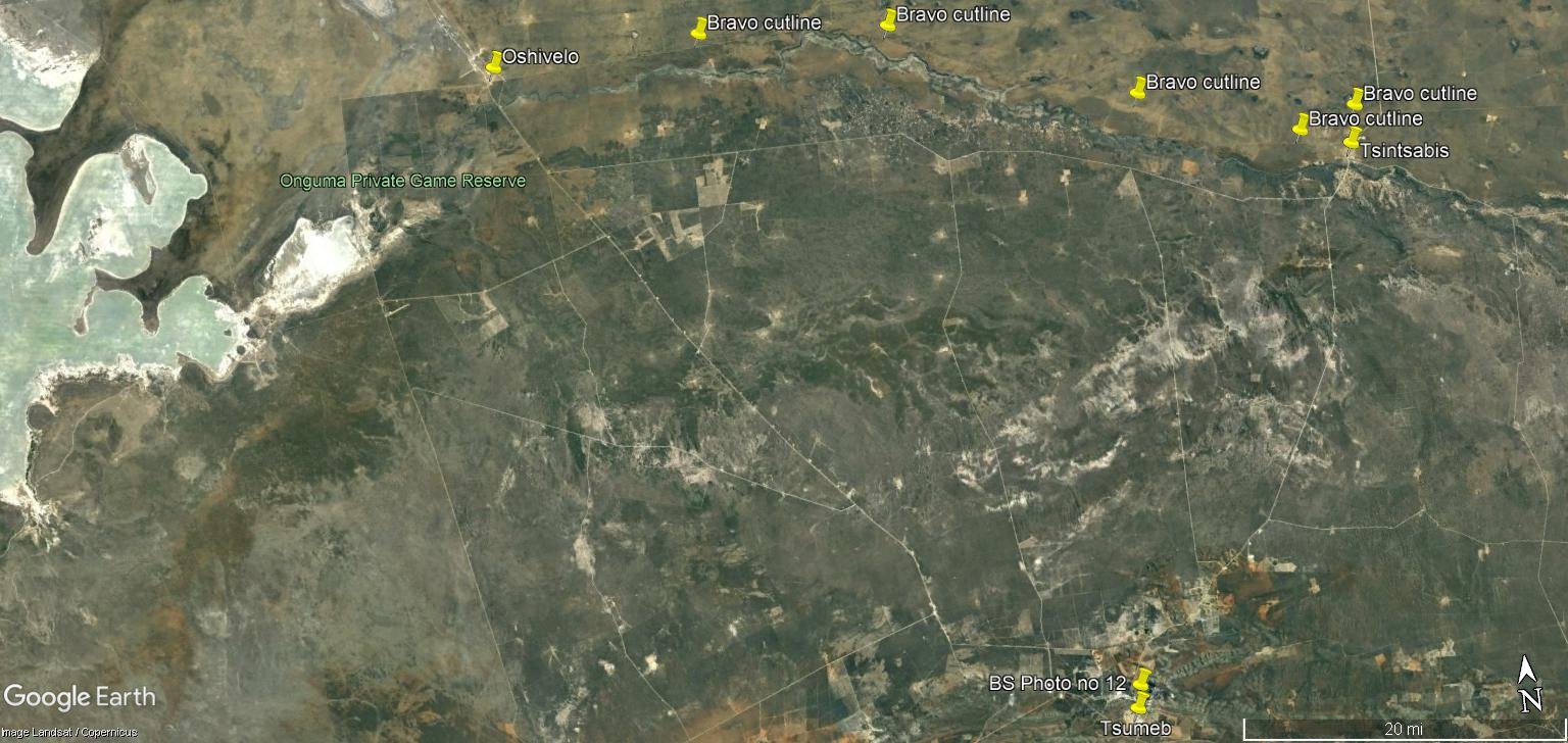
Area view of Tsumeb/Tsintsabis/Oshivelo. The roads from Tsumeb to Tsintsabis and Oshivelo are clearly visible. At Oshivelo 'gate' the road passed through an agricultural barrier into Ovamboland. Otavi and SWASPES is out of frame at the bottom, with the Etosha Pans at left.
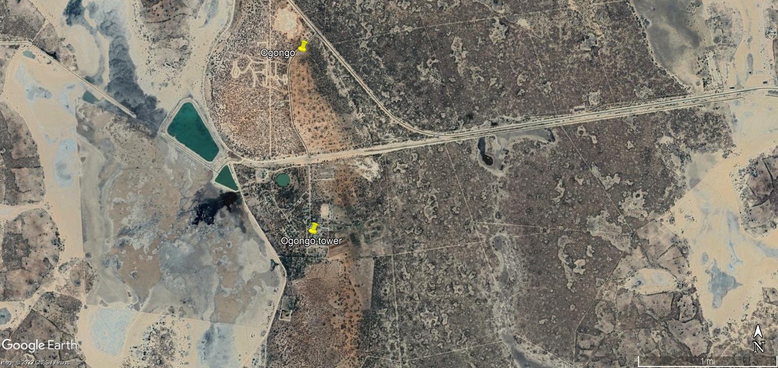
Ogongo area in 2022.

Ogongo in 2015. The area around the yellow pin is believed to be the old base, with a water tower visible at the northern edge of the bushed area. Does anyone have an accurate memory of the place?
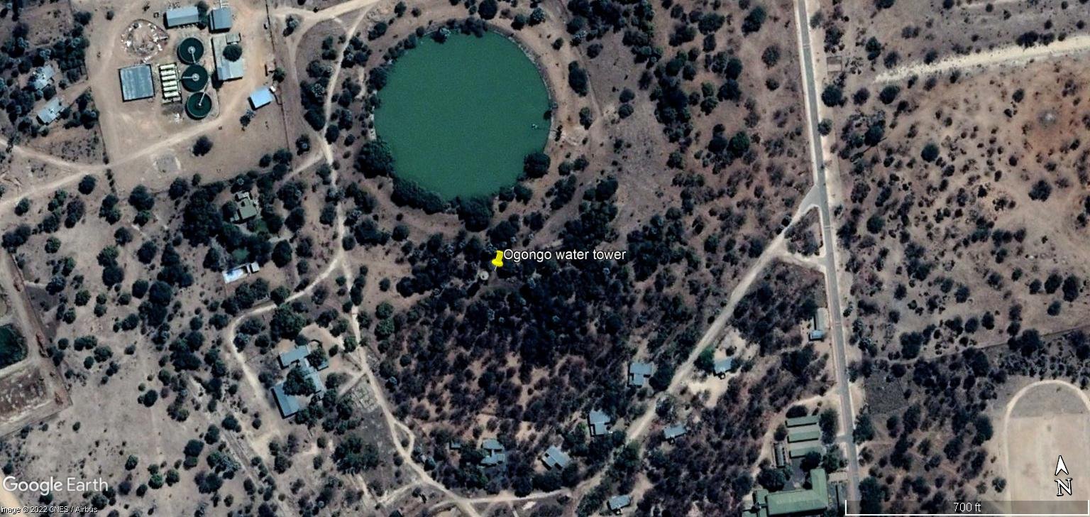
Ogongo in 2022

Mahanene in January 2022. The base is on the north side of the fish farm, Ruacana road visible bottom left. The extent of deforestation since 1982/3 is quite frightening.

Closer view of Mahanene. The north-south narrow rectangular shape is clearly visible, the gate was in the lower right corner where the two dirt roads meet. Around 2006/7 the shapes of the pool and the officer/NCO bar were still clearly visible on Google Earth.
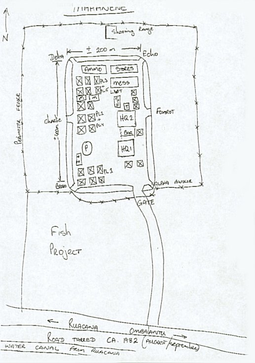
Drawings from memory of Mahenene by Cpl. Jakes Louw of 3 SAI, who was in the base during Platoon 12's abbreviated stay in late 1982.


Tony Foster of Platoon 13 photo, 1983.

Okatope around September 1980, with a (good) drawing of the same scene below.


Okalongo

Okalongo, looking east (?)

Oshigambo

Oshigambo's east wall, date unknown but many years later.

Ombalantu, details unknown.

Ombalantu, details unknown but appears to be in the early days, a work in progress.

Inside Ombalantu base.